5/5
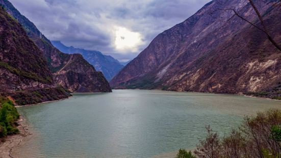
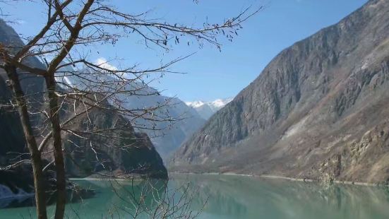
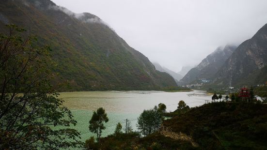
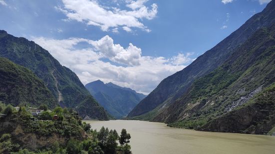
1933年,7.5级地震使岷江岸的山峰笔直地陷落500余米,叠溪台地高于江面270余米的蚕陵重镇,在一道白色地光闪过瞬间轰然坍塌、荡然无存,21个羌寨覆灭,6865人暝目九泉。震后第45天堰塞湖溃坝,20丈高的狂涛倾泻而下,冲毁都江堰水利设施,2500余人遇难。地震留下地质相对稳定的公棚和白蜡寨两个大小海子,就是今天的叠溪海子。 听爵士的流氓兔
0

 FJIBCNBA
0
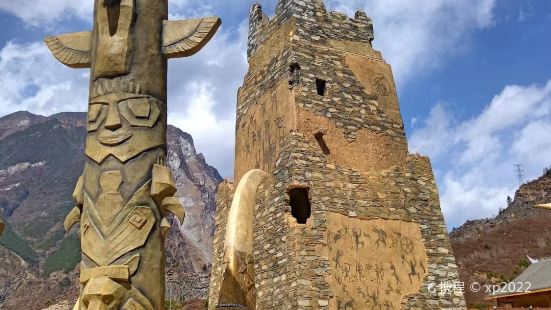
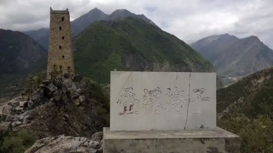
The Diexi Earthquake Site is located 2.5 kilometers southeast of Jiaochang Township, Maoxian County, on the second-level platform on the east bank of the Minjiang River, with Qizhu Mountain as its back and Minjiang River down, with an area of 220,000 square meters. According to literature records, Diexi Han was Canling County, early Tang was Jizhou, Ming Dynasty was Diexi Qianhuo, Qing Dynasty was changed to Wei, and later it was attached to Maoxian. Diexi City was built during the Zhenguan period. In the eleventh year of Ming Hongwu, the imperial envoy Ding Yu asked Tong Sheng to restore the old place. It was one zhang high, three hundred and dozens of zhang around, and four gates. Xicheng is located on the edge of Songmao Road, which is not only an important military town but also a distribution center for merchants and tourists. On August 25, 1933, a strong earthquake with a magnitude of 7.5 occurred here. At that time, the central part of the entire Diexi City collapsed almost straight, and all 21 Qiang villages were submerged. dammed lake. The local people are used to calling the lake "Haizi", so this dammed lake of more than 3.5 million square meters was named "Diexi Haizi", with a total of two Haizi. After the earthquake, only a corner of the east gate of the ancient city remains, and a section of the south wall has a stone lion, a stone roller, a stone tablet and a stone jar. The site is still well preserved, and is an important site for the international earthquake research community to study earthquakes, and a state-level cultural relics protection unit. In addition, there are also some scenic spots such as Jiangtai, Fugui Mountain, Stealing Oil Cave, Yulei Cave, and the return tour of the tortoise.
听爵士的流氓兔FJIBCNBA