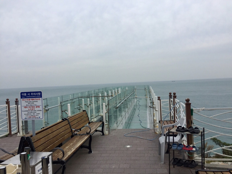
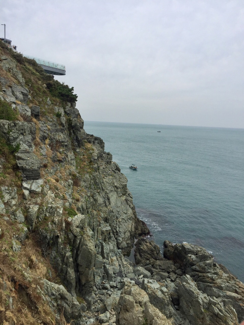
Wuliu Island, located in the southern area of Busan, is a Rock Island with different tide rising and falling conditions. Five or six islands are exposed every day. Wuliu Island, a protected natural area in Busan, consists of two parts: Yushuo Island (32m), Yingshuo Island (33m), Cone Island (37m) and Oyster Island (68m), which are uninhabited islands. The bottom of Yumou Island is an island, but the upper part is divided into two landings. When the tide fades, the sea water appears as an island. When the tide rises, the bottom of Yumou Island submerged by the sea water becomes two islands, thus including the surrounding islands, sometimes five islands and sometimes six islands. One of the two Yumou islands is called "Pine Island" because of its many pine trees, and the other islands is called "Shield Island" as if shielded against Pine Island. Six islands formed 100 million years ago in the Cretaceous Period in the sea breeze and wave erosion and uplift movement gradually changed to the present situation. In 1972, Wuliu Island was designated as the No. 22 monument of Busan. In 2007, it was awarded as the national designated cultural heritage. The sky trail on the rock cliff of 37 meters high was U-shaped. When the weather was not ideal, the rock with strong sea breeze was closed and steep view was far away. Fang Baiyun, the blue sky, fishing sails and the islands scattered in the sea are moving like mountains and loyal guards guarding the sea area.
;
Oryukdo Island Review
4.5 /5103 Reviews


1 / 6


5/5
Oryukdo Island
Posted: Sep 22, 2017


4 person liked this
Like
 4/5ExcellentOriginal Text
[Check in January...] I really love Wuliu Island and Taizongtai are really beautiful! ! [Everything is so beautiful] I hope the epidemic will pass sooner, and then return here to review again.
Posted: May 7, 20200 5/5OutstandingOriginal Text
This is the most beautiful island I have ever seen. Although it is not big and has no beach, it is more natural and beautiful than those islands in Thailand! ! And the key is no one! Photos are taken casually! ! This is also a point that attracts me. A small island that can be undisturbed and quietly enjoy the taste of the sea breeze has also had a lot of variety shows to shoot in recent years. Slowly, the popularity has risen. I will go again if I have the opportunity.
Posted: Mar 21, 20200 4/5ExcellentOriginal Text
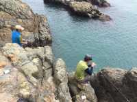
The seaside of Wuliu Island, Busan, is located in the east of South Korea. You can see the sea when you travel here, but the seaside of Busan is not the kind of beach with delicate beaches, but the stone beach with messy rocks. On the beach, you can see the stones built into small towers and stone piles. I found that Koreans like this game very much. We also saw a lot of small stones like this on the beach in Jeju Island City. I don't know what the moral is. It looks quite fun.
Posted: Feb 1, 20200 5/5OutstandingOriginal Text
It's so pretty. The weather is nice and the scenery is good. It's also Busan. I always want to go
Posted: May 19, 20230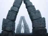 5/5OutstandingOriginal Text
Some distance away, we take a taxi directly to the barbecue shop around Wuliu Island for dinner. There is a bus at the entrance to Wuliu Island. When we get back, the same bus goes back to the city center to change the subway. The scenery is still good.
Posted: Mar 2, 20173 5/5OutstandingOriginal Text
Wuliu Island is located at the end of the southern area of Busan. Every day, five or six islands will be exposed according to the tide fluctuation. It is a protected natural area of Busan City. The island is a rock island, consisting of two parts. Out of the five islands extending from land, all but Lighthouse Island are uninhabited. The five islands are Yushuo Island (32m), Eagle Island (33m), Cone Island (37m), Oyster Island (68m), Lighthouse Island (28m), of which Yushuo Island is also known as Shield Island and Songdao Island. The lower part of the two islands is almost connected. When the tide rises, it looks like an island, and when the tide ebbs, it becomes two islands. The name of the island probably comes from this natural phenomenon. Wuliu Island is the only place for all kinds of ships entering Pusan Port, so it is also the symbol of Pusan Port.
Posted: Dec 30, 20166 5/5OutstandingOriginal Text
Wuliu Island is a nature reserve in Busan City, which shows its importance. It can be seen from the APEC World Peak Building. It has a lovely point, that is, with the ebb and flow of the tide, five islands and six islands. The disappearing island is also a wayward Haha "traffic" bus to 56 islands at Busan Railway Station. It's very convenient. You can go directly to the entrance of the scenic spot, oh "tickets" without tickets. The scenery is wonderful. The conscience government "delicious food" are all over here Ken Be sure to eat the freshest seafood. Many of them are fresh and inexpensive. They are really conscience spots.
Posted: Dec 30, 20163 4/5ExcellentOriginal Text
This island is very windy, and the waves are very big, there are many rocks in the middle of the sea, the waves hit the rocks, the voice is very loud, it is suggested to wear more clothes, the scenery is good. If you pass by, you can go and have a look.
Posted: Jan 24, 20182- 1
- 2
- 3
- 4
- 21
Popular Destinations
Las Vegas Travel | Tasmania Travel | Yangzhou Travel | Doha Travel | Toowoomba Travel | Emerald Travel | Hyderabad Travel | Fukuoka Travel | Sheffield Travel | Prague Travel | Sale Travel | Hakone Travel | Port Melbourne Travel | Jervis Bay Travel | Wenchang Travel | Echuca Travel | Samal Island Travel | Vang Vieng Travel | Guatemala City Travel | Chaoyang Travel | Minoh Travel | Okinawa Travel | Sierra de la Demanda Travel | Yongjing Travel | The Valley Travel | Tierra de Merida - Vegas Bajas Travel | Denali National Park and Preserve Travel | Marsannay-la-Cote Travel | Dominica Travel | La Serena Travel
Recommended Attractions at Popular Destinations
Bangkok attraction near me | Tokyo attraction near me | Manila attraction near me | Hong Kong attraction near me | Seoul attraction near me | Taipei attraction near me | Los Angeles attraction near me | New York attraction near me | Shanghai attraction near me | Kuala Lumpur attraction near me | Shenzhen attraction near me | Guangzhou attraction near me | Osaka attraction near me | Singapore attraction near me | London attraction near me | San Francisco attraction near me | Beijing attraction near me | Macau attraction near me | Bali attraction near me | Paris attraction near me | Orlando attraction near me | Jakarta attraction near me | Ho Chi Minh City attraction near me | Phuket attraction near me | Chicago attraction near me | Toronto attraction near me | Cebu attraction near me | Dallas attraction near me | Istanbul attraction near me | Dubai attraction near me
Popular Attractions
The Peak Tram | Tongli Ancient Town | AQWA The Aquarium Of Western Australia | Hobbiton™ Movie Set Tours | Tokyo DisneySea | Ba Na Hills | Royal Arcade | Ocean Park Hong Kong | Tiger Leaping Gorge | Everland | Sovereign Hill | Pearl River Night Cruise | Xi 'an City Wall | Dujiangyan Irrigation System | Mingsha Mountain Crescent Spring | Monumento a "Juan de Padilla" | Monumento a la Duquesa de la Victoria | Monumento a Julio Romero De Torres | Parque de Ferrera | Monumento A Chanquete | Parque de Consolacion | Ha Long Bay | Humble Administrator's Garden | Universal Studios Hollywood | Qingliang Valley Scenic Area | Gold Coast Sea World | Waterbom Bali | Te Anau Glowworm Caves - RealNZ | TEDA Aircraft Theme Park | Phi Phi Islands
Popular Travelogues
Bangkok Travelogue | Tokyo Travelogue | Hong Kong Travelogue | Seoul Travelogue | Los Angeles Travelogue | New York Travelogue | Shanghai Travelogue | Kuala Lumpur Travelogue | Shenzhen Travelogue | Osaka Travelogue | Singapore Travelogue | London Travelogue | Beijing Travelogue | Macau Travelogue | Bali Travelogue | Paris Travelogue | Phuket Travelogue | Toronto Travelogue
Payment Methods
Our Partners
Copyright © 2024 Trip.com Travel Singapore Pte. Ltd. All rights reserved
Site Operator: Trip.com Travel Singapore Pte. Ltd.
Site Operator: Trip.com Travel Singapore Pte. Ltd.