Li Bai's "Sleepwalking Tianzhu" Tianzhu Mountain Beidoujian is the mountain of Gaode map at 870 meters above sea level. I didn’t get the navigation position at the entrance of Tianzhu Mountain. I felt that I was on the 605 township road. I was not all right. I sweated. I simply saw the recruit and asked again. As the saying goes, the road to the sky is endless (haha), sleep, wake up at 6 o’clock on May 3, hurry up and get up (the sunrise time is 06:13), sunny days, visibility is particularly good! Do bus No. 2 or No. 4 to Xinchang East Station (see the rose flowers on the roadside of Xinchang County, the flowers are oversized and red, the streets are very beautiful, and the garden city! The small hours are scattered on the slope of the villa, which is really poetic and picturesque), and then do the Confucian Line bus, three yuan, south along the 104 National Road, After passing the ancient village of Banzhu, I didn't get off the bus. I went to Banzhu Laoyang Bridge and didn't get off the bus. Then I felt wrong at the next stop. I quickly got off and walked back. Can't see the road of passers-by. I met a farmer's wife near Banzhu Laoyang Bridge and asked her the way. She was very enthusiastic. She said that she walked about 200 meters to the south. There was a fork in the road, downhill on the left, asphalt road, and then a while. There was a sandy road in the field. You can climb to Beidou tip. I went to the intersection, and the AutoNavi navigation showed 605 county road. There were people at the intersection and the passers-by were not clear. Along the 605 down 500 meters, I saw two ploughers, and asked, and his patient and polite guidance: continue to move forward, see the small mud road on the left and go down. I went forward and saw the path, which was very narrow. It was not like a tourist climbing road. I thought about it and found an inconspicuous road sign next to it. "Tianlu Mountain Qingyun Ladder Mountain Climbing Road". I was happy. I followed the sign for a few minutes and saw the Erpan Bridge all the way. I really went right, haha! All the troubles were left behind, the surrounding air was fresh and the green leaves were dewy. Tea leaves were pulled out of the inner buds. Time is 8 o'clock in the morning, and then climb the mountain along the way, there are stone steps, engraved with the words Tianlu Mountain, all the way to peace, more sandy roads, no steps. Fold a bamboo raft action crutches, and borrow the cloth left by the donkey friend to wrap the handle, very hand-to-hand trekking pole, haha. After the spring water, the spring water is clear and sweet, to the Longyin Waterfall, the tiger runs Longyin Yinyan Spring! Feel the dream of Li Bai, but only the birds singing everywhere, no chicken calls! "You can pick the stars, smell the chicken in the air" situation is fascinating! After I felt the waterfall spring and took pictures, I continued to climb the mountain in great spirits. After climbing to an altitude of more than 600 meters, I saw the signpost "campground". I didn't see anything in the past 200 meters. It seemed to hear people, shouting and no response, so I returned to Beidou tip. I saw a small wood like a scorpion on the road, and I forgot to bring it after taking pictures. Later, I picked up a triangle stone. I named "Beidoujian" and decided to bring it. The stone came to work, haha! After a few very steep places, I finally arrived at the peak of the crane Taipei Doujian at 10:50! Take pictures as a souvenir. Along the way, playing stopped, was caught up by a retired couple, and then caught up with a grinding uncle. No one else, it is really a place that is inaccessible. I walked for ten minutes to the campground to supply supplies. I walked along the driveway and saw a large open space. If there is water at the bottom of the valley, but I didn’t move forward (maybe along the Xida Longyin Waterfall and Erpan Bridge) and asked for directions. I took a bus to National Highway 104 and took the bus to Ruxu Town. To fill your hunger and charge to buy Longjing. Ruxi Town has beautiful scenery.
;
Tianmu Mountain Review
4.4 /587 Reviews


1 / 15


5/5
Tianmu Mountain
Posted: May 5, 2019


43 person liked this
Like
 5/5OutstandingOriginal Text
#Tianlu Mountain Snow Scenic Spot Come to our Xinchang, immersive feeling of "a whole Tang poem, half in Xinchang" the vein awakening, where Li Baimeng began. Only 15 pictures can be put, too few. Shooting on February 8
Posted: Feb 8, 20241 4/5ExcellentOriginal Text
The highest peak Jinyintai is still being renovated, and the scenic spot is free to enter with an appointment ticket. There are very few tourists. After the ticket is checked by the visitor center, take the scenic bus up the mountain. There is a location that is not full and it departs every hour. Some roads are blocked in repair, some temporary mountain roads, the slope is very steep and slippery, must wear tourist shoes to go.
Posted: Aug 18, 20232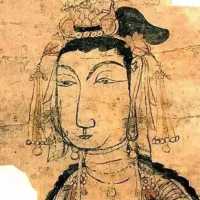 5/5OutstandingOriginal Text
"Tianyu is facing the sky, and the five mountains are hidden in the red city. The rooftop is 48,000 feet. Li Bai wants to fall southeast of this." Li Bai's poem depicts the momentum of Tianyu Mountain in full. It is a good place with a rich cultural and beautiful scenery.
Posted: Jul 19, 20235 5/5OutstandingOriginal Text
From the Yellow Ni Bridge at the junction of Xinchang and Shengzhou to the cross bridge at the junction of Xinchang and the rooftop. It is legendary that climbers can hear the fairy sky singing, so they get their name. Tianzhu Mountain is composed of mountains such as the tip of the clouds, the tip of the thin tip, the tip of the big tip, and the layers are stacked, thousands of shapes, and the sky is full of sky.
Posted: Jul 12, 20233 5/5OutstandingOriginal Text
Catch up with the free ticket period, it should not be fully developed, basically straight ladder up, look at a loft, do not go back down the mountain, do not take an hour, there is no Tianqi even the sky to the sky, the force of the five Yue cover the spectacular of the red city, I don't know why Li Bai sleepwalked here, Maybe the route and the tour season are inconsistent
Posted: Mar 5, 20233- 1
- 2
- 3
- 4
- 18
Popular Destinations
Zamboanga del Norte Travel | Munich Travel | Katherine Travel | Jeddah Travel | Azerbaijan Travel | Dubai Emirate Travel | Johor Bahru Travel | Cooktown Travel | New Delhi Travel | India Travel | Cambodia Travel | Athens Travel | Province of Bali Travel | Waitomo Caves Travel | Burnie Travel | Boracay Island Travel | Cesme Travel | Edisto Island Travel | Horsham Travel | Lombok Travel | Loderup Travel | Cedar Run Travel | Mauritius Travel | Tucepi Travel | Bernardsville Travel | South Point Travel | Highlands County Travel | Hokuto Travel | Provence Travel | Cyberjaya Travel
Recommended Attractions at Popular Destinations
Bangkok attraction near me | Manila attraction near me | Tokyo attraction near me | Hong Kong attraction near me | Seoul attraction near me | Taipei attraction near me | Los Angeles attraction near me | New York attraction near me | Shanghai attraction near me | Kuala Lumpur attraction near me | Shenzhen attraction near me | Osaka attraction near me | London attraction near me | Singapore attraction near me | Guangzhou attraction near me | San Francisco attraction near me | Beijing attraction near me | Macau attraction near me | Bali attraction near me | Paris attraction near me | Orlando attraction near me | Jakarta attraction near me | Ho Chi Minh City attraction near me | Chicago attraction near me | Phuket attraction near me | Toronto attraction near me | Istanbul attraction near me | Cebu attraction near me | Dallas attraction near me | Seattle attraction near me
Popular Attractions
Werribee Open Range Zoo | Samui Island | Petronas Twin Towers | Aquaria KLCC | Universal Studios Japan | Prince Kung's Palace Museum | Gold Coast Sea World | TeamLab Planets TOKYO | Ocean Park Hong Kong | Universal Beijing Resort | Night Safari | Singapore Cable Car | Perth Zoo | St Kilda beach | Pearl River Night Cruise | Rijksmuseum | Immigration Museum (Museums Victoria) | The Bund | Wieliczka Salt Mine | Elseyer Kirche (Ev.-Luth.) | Parco Fanti d'Italia | Kebon Sawah | Masjid | Biserica de Lemn Adormirea Maicii Domnului | Siddhivinayak Temple | Neuapostolische Kirche Hungen | Křížek | Burston Garden Centre | Xylite Park Rink | Disneyland Park
Popular Travelogues
Bangkok Travelogue | Tokyo Travelogue | Hong Kong Travelogue | Seoul Travelogue | Los Angeles Travelogue | New York Travelogue | Shanghai Travelogue | Kuala Lumpur Travelogue | Shenzhen Travelogue | Osaka Travelogue | London Travelogue | Singapore Travelogue | Beijing Travelogue | Macau Travelogue | Bali Travelogue | Paris Travelogue | Phuket Travelogue | Toronto Travelogue
Popular Ranked Lists
Popular Luxury Hotels Near Trinita d'Agultu e Vignola | Popular Luxury Hotels Near Skagen | Top 7 Fine Dining in Dalian | Popular Fine Dining in Macau | Popular Family-friendly Attractions Near Sanyuan | Top 15 Fine Dining in Fukuoka | Popular Family-friendly Attractions Near Yantai | Top 20 Fine Dining in Amsterdam | Popular Family-friendly Attractions Near Nancheng | Popular Family-friendly Attractions Near Datong | Popular Luxury Hotels Near Cauayan | Popular Family-friendly Attractions Near Yuanjiang | Popular Luxury Hotels Near Mimasaka | Popular Luxury Hotels Near Bathinda | Top 15 Fine Dining in Sapporo | Popular Family-friendly Attractions Near Haicheng | Popular Luxury Hotels Near Svilengrad | Top 11 Fine Dining in Hanoi | Popular Premium Hotels Near Dhaka | Popular Family-friendly Attractions Near Yongxin | Popular Luxury Hotels Near Villa La Angostura | Popular Luxury Hotels in Poipu | Popular Family-friendly Attractions Near Zhangwu | Popular Family-friendly Attractions Near Beijing | Popular Family-friendly Attractions Near Xingshan | Popular Luxury Hotels Near Eresos Antissa | Popular Local Restaurants in George Town | Top 20 Fine Dining in Abu Dhabi | Popular Family-friendly Attractions Near Lvliang
Payment Methods
Our Partners
Copyright © 2024 Trip.com Travel Singapore Pte. Ltd. All rights reserved
Site Operator: Trip.com Travel Singapore Pte. Ltd.
Site Operator: Trip.com Travel Singapore Pte. Ltd.